TR-GEO-01-08

Specification
| Height | 133 cm |
| Width | 43 cm |
| Thickness | 13 cm |
| Weight | 13.5 kg |
| Power supply | 12 |
| Modifications | In stock in | Qty | Buy | |
| USA | Russia | |||
Select modifications
Georadar TR-GEO-01-08 is designed for sounding in soils and rock with low and moderate attenuation of radio waves: in sandy soils, moist and dry, in dry clay loam, in rock, limestone, permafrost.
Application:
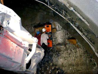
- Construction of underground communications (detection of previously laid pipes, cables, engineering trenches and underground structures).
- Defects checking of building structures, roads, bridges.
- Searching for underground tunnels, communication, soil and reservoir's bottom heterogeneity, as well as ammunition caches, graves, gullies under the road, etc.
- Sounding of various metallic and non-metallic objects, having rather large size (not less then about 0.3-0.5 m), cables, pipes.
- Drawing of geological sections of upper layers of a ground, finding of boundaries of water lenses, alluvia.
- Sounding of cavities and moist areas under road pavement.
- Sounding of cracked areas in rocks, filled by water.
- Sounding of karst cavities, big stones.
- Search of anti-tank mines, unexploded ordnance.
In the georadar TR-GEO-01-08 pulse method of sounding is used. Short electromagnetic pulse is induced by a generator, radiated by the transmitting antenna, propagates through the ground, reflected by some objects of sounding, and comes back to the receiving antenna. Objects of sounding are artificial objects and also natural heterogeneities of a soil, differing from neighboring soil in dielectric permittivity and conductivity, and having sufficiently large size.
A final result of the sounding and processing of signals is radiolocation image of objects and heterogeneities of a soil, imaging of reflecting boundaries and objects, obtained by the processing. The image may be 3-dimensional (3-D), as a number of vertical and horizontal sections of a volume. The image does not give the distribution of dielectric permittivity (density and moisture of a soil), but shows only reflections from boundaries between different layers of soil and heterogeneities or objects. Uniform medium (soil) will not be visible.
By georadar sounding one can distinguish metallic objects or moist areas from cavities in the ground by sign of reflected signal (by colors on radiolocation image).
Main features:
• Shielded (slot) antennas, low radiation to back direction.
• Good quality of sounding pulse.
• The georadar can work in real time with a computer or independently without a computer with saving the data into built-in flash memory.
• Water proof (hermetical) antenna units, separable replaceable batteries.
• Convenient foldable design of antenna unit, fast preparation for work.
• Using of video-camera, storing of video frames with the results of sounding.
• Certificate of compliance with European standards on electromagnetic compatibility
ETSI EN 302-066-1 and -2 V1.2.1: 2008.
Approximate estimation of depth of sounding:
- in dry sandy soils, rocks, permafrost – up to 20 m,
- in wet sandy soils, limestone - up to 10-12 m,
- in dry clay loam - up to 5-7 m,
- in wet clay loam - up to 1-5 m.
Maximal depths of sounding of linear and local objects depending on conductivity of a soil (energy potential of the georadar is 120 dB).
|
Conductivity (S/m) of a soil |
Depth of sounding (m) of metallic pipe with ?15 cm |
Depth of sounding (m) of empty plastic pipe with ?15 cm |
Depth of sounding (m) of metallic sphere with ?50 cm |
|
0.03 |
2.5 |
2.3-2.5 |
2.3 |
|
0.02 |
3.5 |
3.2-3.5 |
3.2 |
|
0.01 |
6.3 |
5.7-6.3 |
5.4 |
|
0.005 |
11-11.2 |
10-11 |
9.1 |
Please see more details here
| Height | 133 cm |
| Width | 43 cm |
| Thickness | 13 cm |
| Weight | 13.5 kg |
| Power supply | 12 |
| Interface | USB 2.0 |
| Current consumption | 1.2 A*h |
| Battery life | transmitting antenna – 3.5 h, receiving antenna – 2.5 h |
Delivery set:
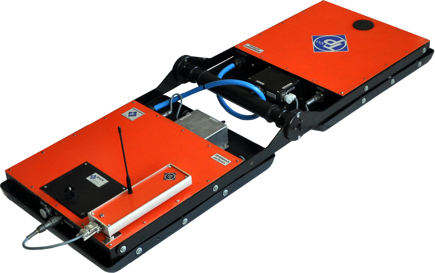
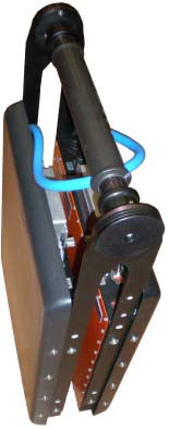
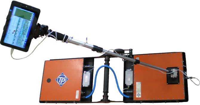
1) Foldable antenna unit of the georadar with generator (built-in into transmitting antenna), receiver, control and store (flash-memory) unit (built into receiving antenna).
2) Two replaceable hermetic battery units.
3) Two battery chargers.
4) Path sensor (wheel).
5) USB cable for connection of the radar to a computer during transmitting of data to a computer or for working in real time regime.
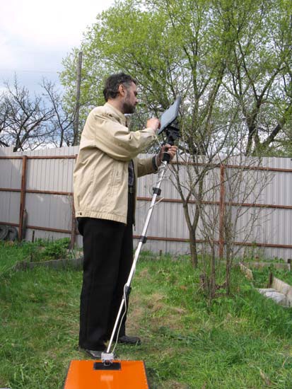
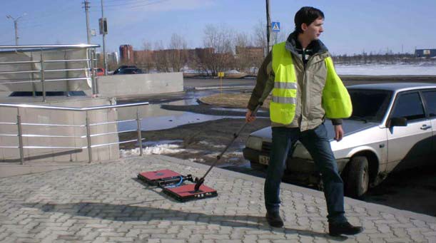
6) Handle with straps for manual movement of antenna unit by operator.
7) Software – program “Radar” for reading of data from the georadar, processing of signals and for imaging of results in form of 2D (profiles) and 3D (volume) images.
8) Documentation set, which includes:
- Brief technical description of the georadar and user manual;
- Description of the program “Radar”;
- Methodology of sounding and interpretation of results of sounding.
9) Program “Radar” on installation disc.
10) Transporting case.
Please note: software upgrade can cause recorder’s breakdown. This is not a warranty case. All the new recorders have the latest software version and there is no necessity to upgrade software after buying the recorder. Don’t take the risk. In case there are problems with audio recorder operation please apply to our technical support specialist: support@ts-market.com
| Software | Firmware | Manual to software |
Series manual | Supplement to the model |
| Brief Description |